No migration detected last night, as the beginnings of a low pressure system brought us wind and rain throughout the night. Southerly flow should return to New Jersey on Saturday, but will likely be accompanied by heavy rain. Migration will likely remain minimal until this recent system clears out and the next system approaches mid-week, setting up clear skies and southerly winds. The next system is expected to pack some precipitation, so we’ll be looking for clear skies and good southerly flow overnight Wednesday, hopefully followed by early morning showers. How’s that for ordering up the weather! 🙂
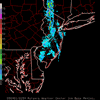
Here’s the radar from sunset yesterday until sunrise this morning:
The radar shows the front of this latest weather system moving across our area yesterday evening.
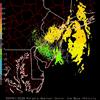
and Here’s the velocity from the same period:
The velocity plot shows movement across the radar in a general ESE to WNW direction at 10 – 20 kts, with heaviest winds during the frontal passage.
***
Thanks to Dana Price and Tom Grzelak from Rutgers Environmental Science for providing me access to the nightly images. Thanks also to Mike Mills for writing the php and Perl scripts which download the images each night. If you remember from last season, there were many days when program I was using to download images crashed, well not anymore!

