National Overview
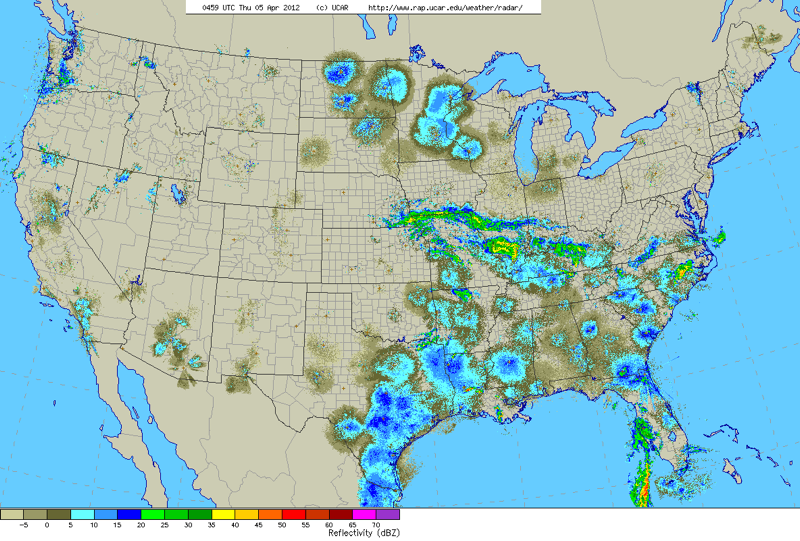
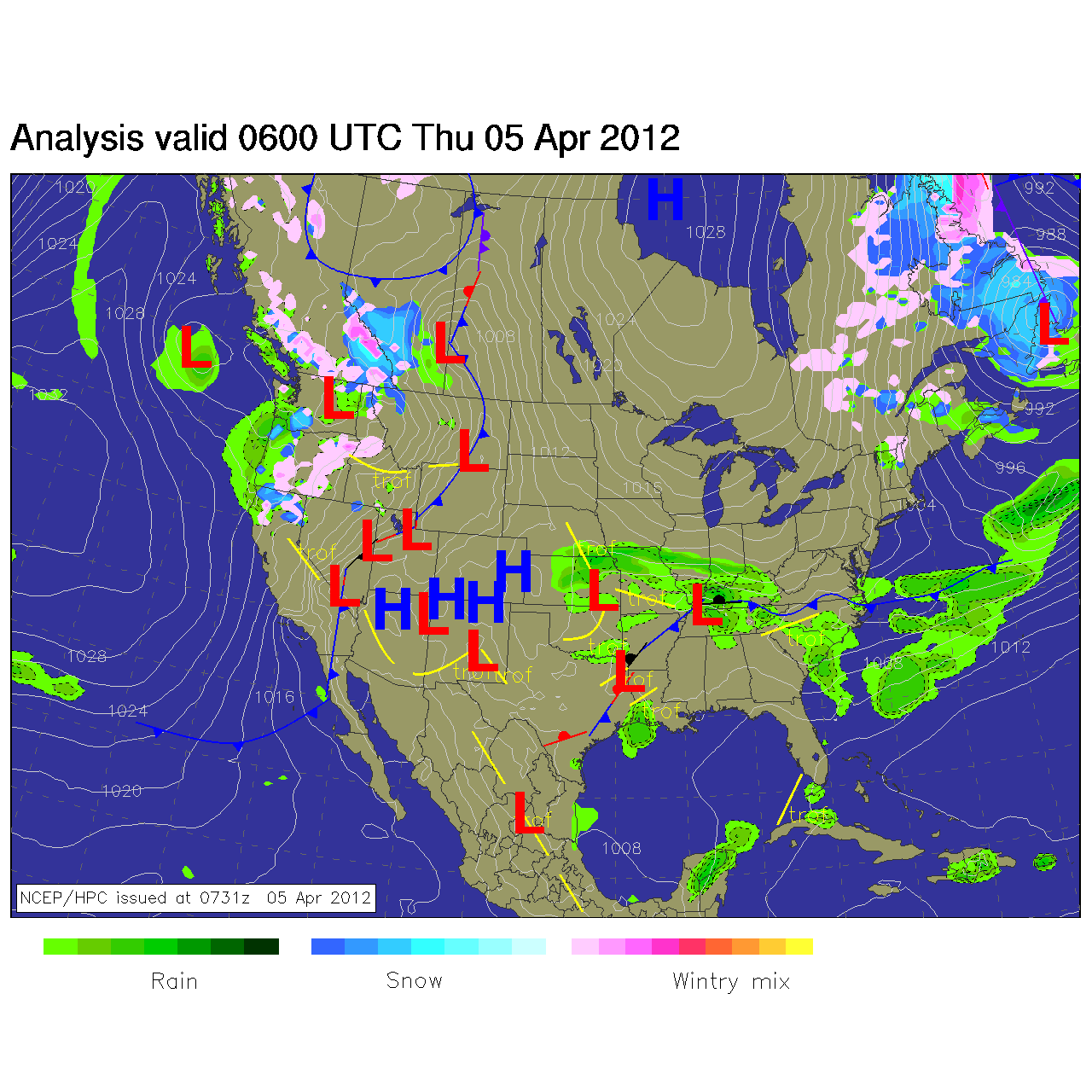
Today I thought it might help to see the synoptic weather map in conjunction with the radar so I’ve posted them both below. A strong frontal boundary across the midsection of the U.S. maintained a solid dividing line between migration over the southern U.S. and that which occurred over the Upper Midwest. As a result, southerly flow from Texas to Florida triggered another night of migration into the Gulf region, and clear skies with light wind over Minnesota, northern Wisconsin and the Dakotas triggered one of the first major movements of birds up into the northern reaches of the country this spring.
Below are the radar loops from sunset last night through 5:00am this morning
New Jersey (Mid Atlantic)
Frames are every 1/2 hour. Click on the thumbnail to view the full-sized animation.
No nocturnal migration evident on the radar last night.
Wisconsin (Upper Midwest)
Frames are every 1/2 hour. Click on the thumbnail to view the full-sized animation.
As you saw from last night’s national composite, Wisconsin falls right on the western edge of a big flight up into the north woods. We can also see this reflected in the local radar, with Milwaukee showing a light movement of birds both out of (early) and into (later) the region. It appears that birds were flying over Lake Michigan last night as they could be see heading WNW from the Grand Rapids radar (not shown) and arriving from the east over Milwaukee this morning. The La Crosse radar depicts another night of moderate to heavy migration as birds move through the Wisconsin and Mississippi river floodplains heading NW. Expect new arrivals in the southern half of the state to be light and scattered, in contrast to a clear increase in density of short-distance migrants and early spring migrants up in the north (especially the northwest). Pine Warbler and Louisiana Waterthrush should continue to fill out their respective breeding locales, while Yellow-throated Warblers and Blue-gray Gnatcatchers should become evident within their typical haunts. Eastern Towhees and Ruby-crowned Kinglets are on the increase as of the last few days, and should continue to push northward as well.
Good Birding,
David


