National Overview
A cold front approaching from the west resulted in southerly flow across the Central Flyway last night, triggering heavy migration from South Texas to the Boundary Waters of Minnesota. In contrast, high pressure over the eastern Great Lakes set up northerly winds over most of the east last night, shutting down migration allowing very little movement in or out of the region.

Below are the radar loops from sunset last night through 5:00am this morning
In an attempt to get the radar posted as quickly as possible, I will be publishing “as I go” each morning. Therefore you may see some incomplete posts throughout the early morning hours (5-6am Central; 6-7am Eastern Time). We’ll test out this method for a few weeks and see how well it works… your feedback, of course, is most welcome!
New Jersey (Mid Atlantic)
Frames are every 1/2 hour. Click on the thumbnail to view the full-sized animation.
No nocturnal migration was evident over New Jersey last night. It looks like we’ll have to wait for the north winds to clear out before we see any major push into the Mid-Atlantic, but the good news is that could be as early as Sunday night… so get your work done this weekend!
Wisconsin (Upper Midwest)
Frames are every 1/2 hour. Click on the thumbnail to view the full-sized animation.
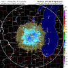
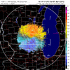
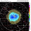
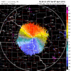
Migration was widespread and dense across the Upper Midwest last night, with heaviest returns continuing to fall along the Mississippi corridor. Looking at the velocity images you can see the direction of movement turn slightly from SE->NW to S->N as birds filled the radar’s view and influenced the velocity values. You can also see that at sunset the winds were between 5-10kts out of the southeast, but as birds got into the airspace the velocities quickly jumped into the 25-30kts range. This is a clear signal that what we’re seeing in the radar are birds and not some other aerial plankton or anomalous propagation of the radar beam. As I said earlier, concentrations were highest along the Misssissippi corridor so expect the biggest influx of new birds to be in this region today. The Chicago radar indicated a lighter flight into southeastern Wisconsin, so expect the best birding in that region to be at local concentration points along Lake Michigan and up into the Door Peninsula. Otherwise expect birds to be dispersed across the landscape today so pick someplace that typically stands out from year to year as a spring hotspot. Alternatively, anyone in southern Wisconsin should consider the annual McFarland Bird Festival (more info here).
As always, woodcreeper.com depends on YOU to report your sightings and be our ‘eyes on the ground’, so please come back and give us an idea of how we’re doing predicting birding conditions in your neck of the woods.
ÂFor migration updates covering other regions check-
Badbirdz Reloaded – Angel & Mariel cover Florida and the Southeast
Birds Over Portland – Greg blogs about the Pacific Northwest
Nemesis Bird – Drew and company give you the skinny on Pennsylvania
Tom Auer (aka The Skua) – Tom’s blog covers New England


